Hiking Acatenango is not for novice hikers. We did a single day hike on Acatenango, and it turned out to become a very long day. In total we spent 11,5 hours hiking with absolutely no training.
Last minute plan
Martin had been wanting to do a hike up a volcano while we were in Antigua. We din’t book any trip in advance because we didn’t entirely agree. There were several options to consider. One was a half-day tour to the Pacaya volcano, which is currently active. This tour allowed us to reach about halfway up the volcano and in the warmth from its interior, bake a pizza and roast marshmallows. The other option was a two-day trip to Acatenango, where the first day included an almost full ascent to the top, an overnight stay in a camp, followed by the final stretch towards the summit early in the morning to experience the sunrise over the volcano, before going back down.
Anton had some concerns about the two-day trip, especially since it fell right before his long flight home. Meanwhile, Martin didn’t want to settle for a half-day tour and later regret not taking the longer tour. We made a compromise and arranged for a guide to accompany us on the two-day trip, but we chose to complete the trip in a single day which not many hikers do.
On the afternoon before our departure, at 5 p.m., we decided to book the trip. In a hurry we got all the necessary equipment, including provisions and plenty of water, which was advised by the hotel. They delivered breakfast and lunchboxes for the trip, and we bought extra water and snacks. We got our backpacks packed and brought hiking boots out.
Acatenango and the trail
Reaching for the sky at an impressive altitude of 3,976 meters, Acatenango is the third highest volcano in Central America. Situated about an hours drive from Antigua in a breathtaking landscape of vulcanoes and mountains. Hiking on its trail is a test of both physical prowess and mental fortitude. From the starting point at 2400 meters altitude, the trail to the summit is 13.7 km long with a 1.6 km elevation gain winding its way through varying landscapes through lush forests and transition into more rugged alpine terrains. The trail’s steep incline categorizes it as a moderate to difficult hike, a journey that demands not only physcial endurance but also mental persistance.
For hikers Acatenango is not only known for panoramic views of the entire region but also in the dry season you get a view of the nearby (and highly active!) Fuego Volcano, that has been erupting continuously since the Spanish conquistadors arrived 500 years ago. We did the hike in the wet season and were aware that our chances of seeing El Fuego were minimal.
Beginning
Our driver picked us up early in the morning, and drove us to the starting point. Due to time constraints, the booking company could only offer a guide with basic understanding of English. He lived nearby and had been a guide for six years, so we figured, it would work out. We rented some wooden sticks carved by local children, who earned a bit of money from hikers. Well-equipped with 4 liters of water each, we were prepared for a full-day hike, which supposedly would take around 5 hours uphill and approximately 3 hours downhill.
First part of hiking Acatenango – up to the national park entrance
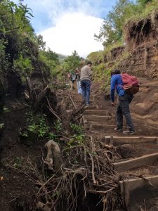
The first part of the trail was very steep and led through agricultural areas surrounded by barbed wire fences. The trail had been washed away by rainwater in many places. Occasionally, there were large deep holes dug to collect rainwater in order to protect the path. A dog started to follow us and stayed with us for a long while.
I quickly became short of breath. My thighs were already burning, and we were only half an hour into a 5-hour ascent. We had breakfast at the first stop. The hotel was supposed to prepare a sandwich for each of us for both breakfast and lunch but had only packed 4 sandwiches and a bit of fruit for the entire trip. Sigh! Luckily, Martin and I had gone a bit crazy buying nuts and chocolate the evening before, so we had enough food for the whole day and decided to continue.
After breakfast, a long stretch with stairs followed. It became an endurance test for all of us. Elliott and I started falling behind. It was a bit too much for our legs after months without exercise. We had to take multiple breaks. The guide’s estimates of when we would reach the summit kept getting pushed back as we became slower and slower. He promised us a less steep stretch after the stairs. When we got there, it was indeed less steep but still uphill.
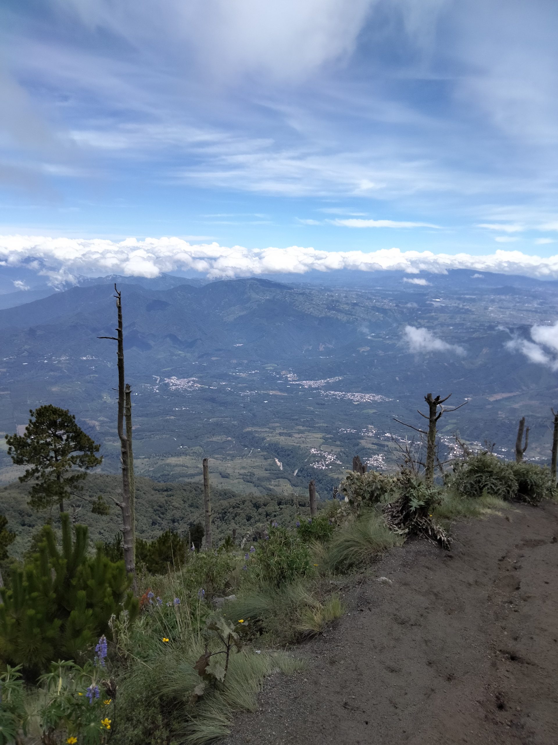
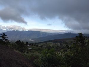
The sky was partially cloudy around us. Occasionally, the cloud cover would open up, revealing the most breathtaking views. We would forget the pain in our bodies and hurriedly take pictures before the clouds obstructed the view again. There was definitely an ambiguity in the body – it hurt and tried to say stop, yet we got new energy derived from the most splendid surroundings, acting as a sort of reward for endurance.
Soon, Anton encountered difficulties as well. He used to be the most physically fit in the family, but a year of relaxation on a boat clearly wasn’t good for his fitness. Carrying sweaters, jackets, and plenty of water in our backpacks didn’t make it any easier. Rarely have we seen Anton feel defeated during physical activities. He usually gets us all involved and encourages us to explore new things.
Surprisingly, Martin did remarkably well on the initial stretch, considering he had undergone surgery just 2 months ago.
Victor was the only one who had no issues. Right on the guide’s heels, he couldn’t understand why the rest of us struggled to keep up.
After about 2 hours of hiking, we reached the entrance to the national park and had a well-deserved break.
Second part of hiking Acatenango – through the lush sky forest
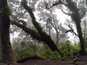
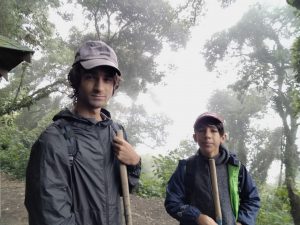
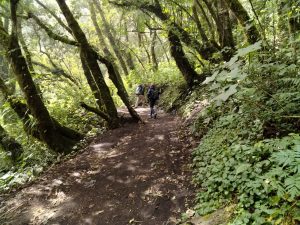
We had now ascended so high that the clouds enveloped us like a dense fog. It had gotten so cold that we had to pull out our jackets. The guide informed us that we were now entering the cloud forest, where vegetation is supplied with water directly from the clouds as condensation. Even though the magnificent views were no longer visible, the forest was truly beautiful in an almost heavenly mist.
At one point, Elliott started struggling to keep up and felt like giving up. Martin had to drop to the back of the group and encourage him forward. Despite advocating for hikes throughout our journey, Elliott had felt that we hadn’t done enough hiking in the other countries we visited. Now he was facing a hike of a lifetime.
We drew inspiration from travel shows on DR(a network on danish television), where the main character Berthelsen embarked on a pilgrimage route in Shikoku, a show that Elliott and I had watched together. That hike is high on Elliott’s bucket list. When it got tough on the pilgrimage route, Berthelsen learned to chant like the pilgrims. We didn’t quite remember the exact chant Berthelsen used, so we made up our own rhyme. Martin had promised the kids pizza if we all made it to the top. So, Elliott began to chant his favorite pizza toppings… “pepperoni, arugula, ham, pepperoni, arugula, ham…”. As silly as it might sound, it nonetheless helped with our progress. Elliott regained his energy, and after a while, I was once again at the back of the line.
Based on our pace, the guide predicted that we would reach the top by 1 p.m. Although it was tough, it still seemed manageable.
Third part of hiking Acatenango – through the alpine forest
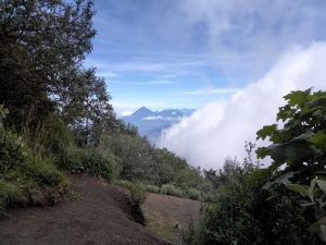
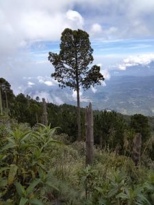
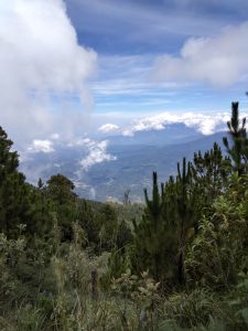
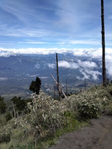
As we had passed the cloud forest, it had become so chilly that we were now walking in an alpine forest with coniferous trees and more space between the vegetation. We had risen slightly above the cloud cover and were once again greeted with some truly stunning vistas. Along a portion of the way, we ascended alongside a mountainside with charred trunks and barren ground. A forest fire had swept through in 2016, clearing a significant portion of the mountainside completely. Apparently, it takes a long time for vegetation to recover.
We could feel the difference in the air, indicating that we had reached a high altitude. Martin and I, in particular, found it harder to catch our breath. He even got dizzy a couple of times. We practiced deep breathing and had to engage in some mental training to keep pushing forward.
Elliott had made an impressive comeback and was leading the way along with the guide and Victor.
The higher we climbed, the sparser the vegetation became. The ground grew looser, making it harder to maintain a steady foothold in the terrain.
The guide had adjusted his time estimate to 2 p.m. We were approaching the last stretch, which the guide described as very steep. We braced ourselves for what we anticipated would be the toughest 50 minutes. But that was okay because the journey downhill would be easier, right?
On the second-to-last stretch, I was becoming quite strained. The thin air was taking the breath out of me, and mentally, it was challenging because I knew the hardest part was still ahead. Each step felt heavier, and I cursed the many liters of water that the hotel had made us carry but which we hadn’t consumed much of.
Final part of hiking Acatenango – in bare terrain up to the summit
We felt the air getting thinner and it became more difficult to continue. On the final stretch, trees and bushes disappeared, leaving a barren terrain of loose gravel that was hard to gain traction on. The trail became less and less visible. The wind intensified, and clouds being pushed up the volcano’s side obscured our visibility.
The guide led us to a narrow ridge with steep edges on both sides. The trail was no longer discernible. He walked a few meters ahead, often going out of sight. Then we encountered some rocks which provided better footholds, but the ridge seemed to narrow down further and further. Even Victor started feeling uneasy. The wind grew stronger as we ascended. Martin and I paused for a moment, considering whether it was time to turn back, but the kids were already ahead with the guide, and we were very close to the summit. We chose to continue the last stretch. We were frustrated that the guide hadn’t informed us that reaching the top wasn’t just strenuous but also perilous.
Cold and slightly shaky from the last stretch, we reached the summit in thick cloud cover. It was now 3 p.m. The clouds and wind pressed against the volcano’s side, adding a chill factor to the already cool air.
It had taken us 7 hours to reach the top. The pizzas for dinner were now granted.
We waited a bit to see if the cloud cover would clear and we could catch a glimpse of our surroundings, but in vain. We heard distant thunder, and the guide felt it was time to hurry down. If it rained lower down, descending could become dangerous.
The descent
On the way up, Martin had already felt his right knee, which had been bothering him due to arthritis for a few years. From experience, he knew it would hurt more on the way down and had prepared with painkillers for the descent.
The first part went fine, but the longer we descended, the more painful it became. The rest of us were also quite tired. My knees began to ache, and our steps grew shorter and shorter. Everyone was exhausted, and now the goal was just to get down before the thunderstorm caught up with us. The guide led the way with very few stops on the descent.
Martin used his trekking pole to relieve his right knee, but in doing so, he strained his left knee, which also started hurting. At one point, he started walking backward. It helped for a while, but navigating backward on uneven terrain with many twists and turns proved challenging.
I realized that my hiking boots were a size too small. With each step in the downhill terrain, my big toes jammed into the front of the boots. Step after step, it got worse, and the pain extended up to the base of my nails.
We passed the camp where other hikers were preparing to set up camp for the night, complete with campfires and relaxation. How I wished that was us.
The guide’s initial estimate for the descent was 5 p.m, i.e 2 hours approximately. As we descended further, we grew slower and slower, and the estimate kept pushing further into the future. Martin with knee pain, the kids utterly fatigued, and my legs completely stiff by the end. Even Victor was feeling leg pain and noticed blisters on both feet.
On the last stretch, we passed some locals carrying heavy building materials on their backs, such as pipes and large pieces of tin roofing. A young man stopped by me and asked if I was okay. I felt old!
It took us 4.5 hours to get down. It was a relief to finally sit in the taxi.
Back at the hotel, they smiled at us. Martin managed to exchange our missing packed lunches for pizzas delivered to our hotel room. With pepperoni and ham.
Up next
Back in Rio Dulce, we have a cute new crew member. Our new boat cat, Rio from Rio Dulce.
