Cruising Rio Dulce was not initially on our itinerary. We didn’t even think of visiting Guatemala when we started sailing a year ago.
Back in May, as Martin was going through the very cumbersome check-in procedure in Isla Mujeres in Mexico, he met an American couple. They were heading down to Rio Dulce for hurricane season. It was the first time we heard about sailors visiting Guatemala and Rio Dulce as a hurricane hole.
Since we were already delayed in our schedule with no crew apart from ourselves to sail to Panama, we considered doing the same. After a few days of deliberation and some research, we decided that we would also spend hurricane season in Rio Dulce.
The Sweet River
Rio Dulce meaning The Sweet River is part of the “Rio Dulce National Park”. It is located in the eastern part of Guatemala between the Caribbean Sea and Lake Izabal, the largest lake in the country. Surrounded by mountains and thick jungle, Rio Dulce is a perfect hurricane hole for sailors in the Caribbean Sea.
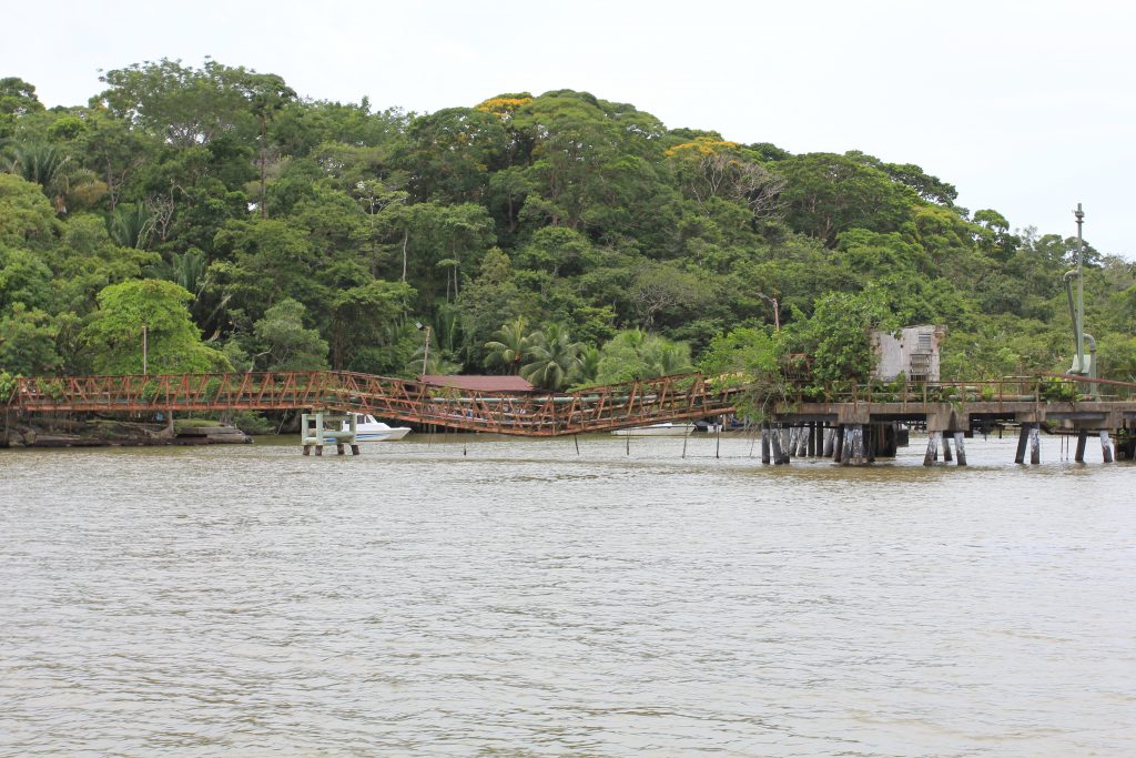
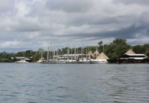
In recent years, Rio Dulce has become a popular tourist destination for sailboats. There are several marinas around the town of Fronteras located by the bridge “Puente de Rio Dulce” north of Lake Izabal.
The river stretches 43 kilometres from Lake Izabal to the town of Livingston at the river estuary in the Caribbean Sea. It was here at Livingston that we checked in and sailed about 25 nautical miles west towards Lake Izabal to our marina near the town of Fronteras.
Entering the river
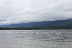
Navigating the entrance at Livingston is a little tricky. There is a sandbank at the estuary that you have to somehow find a way around. Many boaters run aground here and need help from locals to get free and past the sandbank. The passage is only 1.6 metres deep, the same as our boat. Therefore, we had taken an overnight anchorage at Punta Manabique to be able to cross the sandbank in the morning, when the tide was high.
Our marina in Rio Dulce had sent us some coordinates, which we plotted on the chartplotter to avoid the most shallow areas.
There were no markings at the entrance other than a single buoy to show the estuary. The locals had placed small warning flag markers here and there.
It was a bit of a thrill to sail in. As we approached, the depth gauge showed lower and lower readings. There weren’t many centimetres below the keel to the seabed. Fingers crossed we made it without running aground. We dropped anchor right next to our American acquaintances, who had spent the night just outside the sandbank waiting for high tide.

Check-in to Guatemala
Upon our arrival, the check-in agent Raul was standing by in a wooden boat with officials from various authorities. We managed most of the check-in procedure from the boat. All we had to do was go into the town of Livingston, withdraw money for payment and pick up our documents an hour later.
Raul told us, that they had been following our boat and we had sailed completely wrong in relation to the sandbank. It was pure luck that we didn’t run aground.
A quick glimpse of Livingston
We dinghy’ed in to the town of Livingston. It was a short walk to the ATM. The distance combined with the hilly terrain gave Martin some challenges with his catheter.
While we waited in front of the agent’s office with the Americans, a small tuk tuk ice cream van passed by. With it came a long queue of children and adults hungry for something cold in the humid midday heat. An event just like you might experience on a summer’s day in a residential neighborhood in Denmark, yet it felt completely different in this setting.
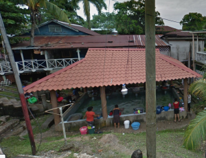
In front of the office was a strange building, quite open with water on the floor and sinks on the sides. For a moment we wondered what it might be. We found out that it was an open air wash house with rainwater running from the roof down to the floor filling it up with fresh water. There were washboards next to the sinks. I didn’t get a picture of the wash house, but here is one from Google maps, where the wash house is open.
Since we were in town, we figured we might as well see if we could a data card for internet. There are two mobile phone companies to choose from. The agent advised us against one of them. The other was completely down due to a storm a few days earlier. There had been up to 47 knots of wind. This was a little more than the mobile phone masts could withstand. When we saw in the street scene how all kinds of wires hung between the wires and masts criss crossed, we could understand why.
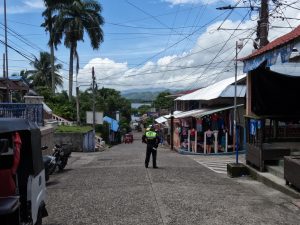
We only had a short tour of Livingston, but it was enough to sense the change in the atmosphere. It was clear that we had entered a completely different culture than the one we left in Belize. Colorful buildings, tuk tuk’s like the ones we know as Rickshaws in Asia, traffic wardens instead of traffic lights and women in traditional Mayan clothing. The colors and patterns of their skirts show which region they originate from.
First part of cruising Rio Dulce
Once the check-in procedures were complete, we had the long-awaited cruise on Rio Dulce coming. It was a trip we had been looking forward to, and it was truly a beautiful trip.
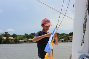
With the Caribbean Sea behind us, we saw a narrow but busy waterway. We were surrounded by lush green jungle and clay-colored water significantly different from that of the Caribbean sea. We changed the flag from Belize to Guatemala, and were ready to leave the sea for the next three to four months.
We passed a wooden dock, destroyed and overtaken by vegetation, about to fall into the river. Anton was at the helm and spotted some electrical wires hanging between the shorelines above the river. Not sure if our draft of 63 feet in high tide was low enough for us to pass beneath the wires, we slowed down at first. Since the agent nor the marina had warned us about this, we figured it was ok to conttinue. Once passing the wires, we could see that there was plenty of space and no need to worry.
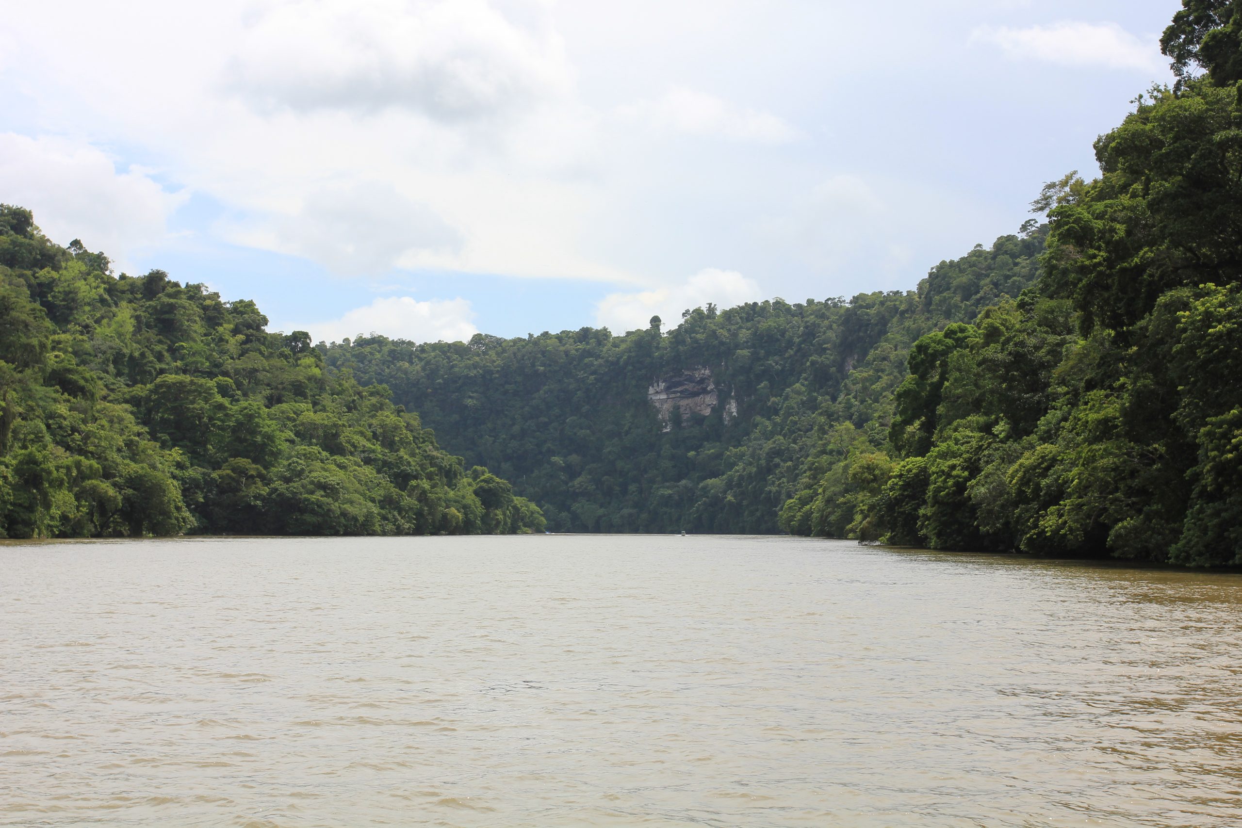
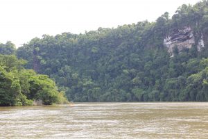
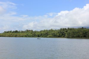
On the first stretch, we sailed through the Rio Dulce gorge with towering high cliffs on both sides of the river. We found ourselves in a thick jungle with lush vegetation, tall trees and the sound of all kinds of wildlife around us. The chirps of birds and the cicadas buzzing followed us on the way. At one point we heard monkeys, but didn’t get to see any.
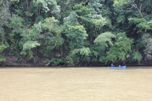
Water taxis whizzed around us at high speed. Local fishermen sat in small canoes and fished with lines. The river was meandering. We took a couple of hairpin turns following the very specific instruction from the agent in Livingston.
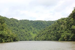
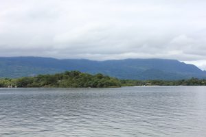
Once we were pass the narrow part of the river, it opened up into El Golfete, the small lake in the national park.
It was getting late and we realized that we wouldn’t be able to reach the marina before closing time. Therefore we decided to anchor at Cayo Quemado, a nice little natural anchorage packed with boats. We found a good spot and spent the night there.
Second part of cruising Rio Dulce
The next day we sailed the last stretch across El Golfete to our marina at Las Fronteras. The sailing on El Golfete was with a somewhat different landscape.
The high cliffs around us changed to an open landscape with a wide lake surrounded by a distant ring of mountains in the background. The water was dotted with mangrove Islands, some of them with clusters of egrets on them. The shorelines were in shade by tall trees and decorated with water lilies.
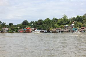
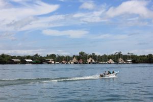
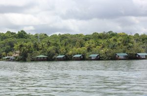
Along the shores, small wooden huts appeared. Some local houses, others similar-looking holiday homes or hotels crammed next to each other. The traffic and crowds of fishing boats intensified. We saw fishermen with home embroided fishing nets, which they threw into the water with a fine technique to spread the net in a perfect circle.
Many water taxis carried families and school children. It made us wonder if there were any roads at all behind the houses, or if it was all jungle.
Arrival at our destination
The day was warm and sunny with thunder clouds in the distance. We had very few moments with cloud cover above us. Martin spent most of the day lying down. We sweated, took trips to sail the boat and took a lot of pictures and video of the beautiful landscape. At the same time, we were happy to experience the beautiful landscape and that we were finally arriving at our destination.
After 5 hours of sailing, the lake became a river again and we started to see marinas on both sides of us. The sight of masts everywhere gave a strange feeling of being close to home; soon in the marina where we will be for the entire hurricane season. Martin got up for the docking manoeuvre, and we were finally here.